Satelite images show floods that stretch from Alzira toward Valencia.
This image from the US Landsat-8 satellite shows the landscape around Valencia on October 8, before the flash flood, and October 30, after it hit.
For scale, it’s about 28 miles from the city of Alzira, shown in the lower left of both images, to Valencia, shown in the upper left.
Satellite images show the destruction of a highway in Spain.
Before-and-after satellite images captured by Maxar Technologies show widespread destruction across the Valencia Province. Depicted here is a highway that was damaged by floodwaters.
As of Thursday, about 300 people remained cut off from rescue due to damaged roads, EFE — Spain’s state news agency — reported.
Flash floods treated cars like legos, piling one atop the other.
The Sedaví area of Valencia is almost unrecognizable in these images from before and after the flash floods.
The floodwaters flipped cars on their sides, inundated highways, cut off main roads, and damaged many homes. Some were forced to flee to their rooftops to await rescue.
Spain’s prime minister Pedro Sánchez said on Thursday that the government had deployed more than 1,800 police officers, 750 civil guards, and 200 soldiers to help in rescue and recovery efforts, EFE reported.
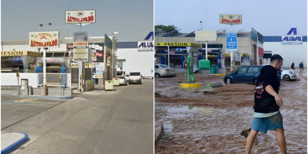
Muddy waters stained the people, streets, and buildings brown.
This bank is in Paiporta, south of Valencia City, where at least 62 people were killed by the floods, some of whom were elderly.
A ravine cuts through the Paiporta municipality. When the storm came through, the ravine overflowed, flooding the entire central area where older houses and older people live, the Spanish broadcaster RTVE reported.
Paiporta’s mayor, Maribel Albalat, told RTVE that they hadn’t received a warning of the imminent danger and people were ambushed by the floods.
It’s the worst flooding Spain has seen in decades and people weren’t prepared.
The storm was caused by what’s called a cold drop, when warm air rises rapidly forming huge cumulonimbus clouds that can then release torrential downpours.
Sudden, catastrophic rain events are becoming more of a problem worldwide as global temperatures rise, largely because warmer air holds more moisture.
In a phenomenon that some scientists call “weather whiplash,” many parts of the planet are swinging violently between extreme drought and extreme flooding.
“You can really go to any continent, in any season, and find something at this point,” Daniel Swain, a climate scientist who studies the phenomenon at the University of California, Los Angeles, told BI in January 2023, after powerful floods briefly broke the drought in California.
Thousands have been rescued but many more remain trapped.
The number of people unaccounted for remains unclear, EFE reported. That said, about 3,400 people have been rescued.
As the planet heats up for decades to come, droughts and rain events will likely become more and more extreme.
That’s one of many reasons scientists have been calling for companies, countries, and industries to drastically cut their carbon emissions. If business continues as normal, research suggests there will be more floods like this in the future.
Read the full article here


