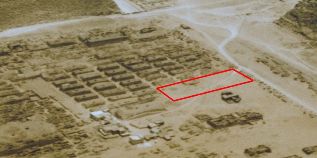
Egypt holds many secrets to its ancient past, and archaeologists may have discovered a new one hidden beneath the sands of the Western Cemetery in Giza.
The Western Cemetery holds hundreds of rectangular tombs called mastabas that line the base of Giza’s Great Pyramid. These mastabas belong to elite citizens and relatives of the Ancient Egyptian king Khufu, who ruled around 4,500 years ago.
However, in stark contrast to the many rows of tombs, one area of the cemetery is bare, with no structures. Below the sand, it’s a different story, archaeologists recently discovered.
What appears to be a flat, sandy surface might hide long-forgotten structures built thousands of years ago. Only a couple of feet below the surface lies what appears to be an L-shaped structure. Even deeper, there’s another, larger structure connected to the first.
The L-shaped structure’s corners are “too sharp” to be naturally occurring, researcher Motoyuki Sato, who helped find the anomaly, told Live Science.
That suggests humans constructed it and might explain why such a large swatch of the crowded necropolis remains empty above the sand, the researchers reported in a paper they recently published in the peer-reviewed journal Archaeological Prospection.
Both features could be remnants of an ancient tomb, according to the researchers. However, the discovery still leaves many unanswered questions.
High-tech archaeology uses radar and other tools to find buried secrets
In the early days of archaeology, it took years of careful digging to uncover the shape and size of a structure. Now, newer technologies can help scientists map previously unknown buildings without removing even a shovelful of dirt.
That’s how researchers from Higashi Nippon International University, Tohoku University, and the National Research Institute of Astronomy and Geophysics in Egypt uncovered this latest hidden piece of history.
Between 2021 and 2023, the team studied the location using not one but two high-tech methods: ground-penetrating radar (GPR) and electrical resistivity tomography (ERT). GPR uses electromagnetic waves to map shallow underground features in high resolution. For deeper structures, ERT can locate walls, shafts, and similar anomalies but without as much detail.
Combining GPR, ERT, and satellite data, the researchers discovered an L-shaped structure measuring roughly 32 by 50 feet buried 1.6 feet to 6.5 feet under the sand. They also found evidence of a 1,000-square-foot structure about 11.5 feet to 33 feet below ground, deeper than the L-shaped anomaly.
The next step is excavation
At some point, the shallower L-shaped structure was filled with sand, which could be a clue to its purpose. It may have served as a kind of passageway to a lower tomb, according to the researchers. Ancient Egyptians often filled up such shafts to keep out the living.
While GPR and ERT can offer a more complete picture of sub-surface archaeological finds, these techniques can only take archaeologists so far. The researchers noted that the two methods’ data didn’t precisely match, and the techniques can sometimes make anomalies appear larger than they are.
Other mysteries remain, too. They don’t know what, if anything, is in the deeper structure. It could be filled with sand or totally empty.
To answer some of these questions, the archaeologists needed to start digging, literally. They’re currently excavating the site, Live Science reported.
Read the full article here


